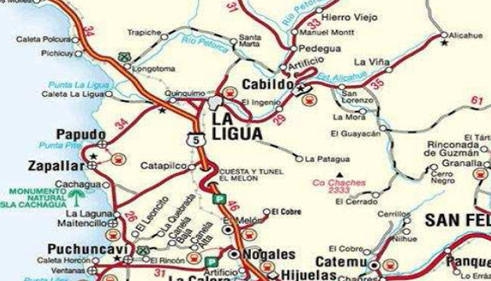
Project Petorca.
V Region, Chile.
Cu, Ag.
Prepared for Metals Finance Corp: May 2007.
Harry Floyd.
Geólogo
Summary:
On Saturday 10th March 2007, visited an interesting copper oxide
project 16 kilometres north east of Petorca at place called Chalaco. The 100 hectare
Mensura is located at the UTM coordinates: E 331508 mts, N 6440738 mts, Provisional
South American Datum 1956, Altitude: 896 meters above sea level. This is a new
discovery and a virgin prospect that has not been developed. Only 400 tons of material
have been extracted and sold from the surface which gave a grade of 1.85% Cu in oxide
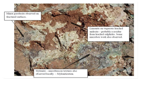
ore. The property covers a round hill that is composed of andesites, andesite porphyry
and andesite breccias with a mild chlorite alteration. The hill as a whole has been
affected somewhat by prophylitic alteration. A number of small workings have exposed
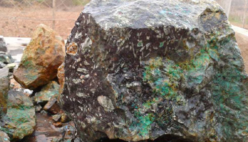
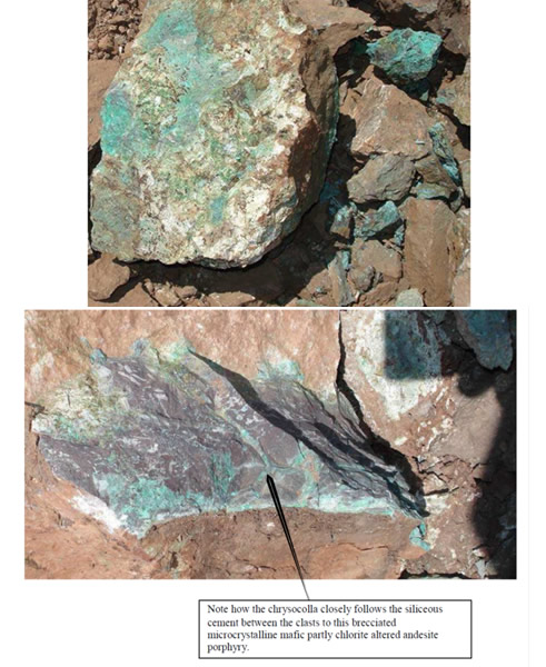
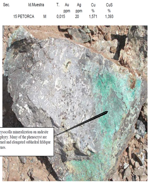
copper oxide – mineralization in numerous locations around the hill. The chrysocolla
copper silicate is mostly restricted to fracture surfaces and stockwork systems rather
than within the actual matrix, although there does appear to be some copper
mineralization within the matrix as well. One thing that took my attention right away
was the relatively low calcite contamination which is excellent news for acid
consumption for any copper oxide project.
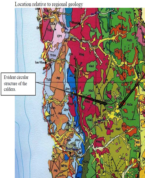
The hill appears to be part of an andesite dome related to the Cretaceous Las Chilcas
Formation on the southern fringe of a large caldera, and also possibly on another fringe
on a more discrete much smaller caldera directly to the south. Added to this there is a
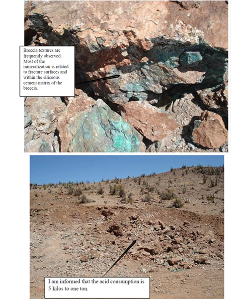
strong regional North-South lineament that can be traced on the satellite image that cuts directly through the property. The combination of these regional structural factors has lead to extreme fracturing locally and on the fracture surfaces chrysocolla has
precipitated from percolating hydrothermal solutions. There appears to have been more
than one pulse of mineralization as chyrsocolla is observed within the matrix of the
abundant breccias as well as within the clasts held by the breccias.
As is common with these types of copper oxide prospects, on the surface there is very
little evidence of mineralization. However only after a meter or so in depth the
mineralization becomes quickly apparent.
The mineralization is very near the surface and the structural parameters of the
mineralization have not yet been defined. For example a long cut with an excavator that
has exposed a large zone of copper mineralization does not appear to have any well
defined wall rock as such. The sample I took there over some 15 meters gave a result of
1.57% Cu total and 1.39% Cu soluble, also a surprising 20 ppm silver result. (Assay by
AA).
The hillside is on the whole not hard to get around although a little steep on the west
side by Chilean standards it’s really comparatively gentle. I would have thought that in
this topography, conducting geophysical surveys such as ground magnetics and IP
would be relatively simple. I would indeed recommend this project for further
evaluation to include trench work with an excavator, mapping, sampling and drilling.
Location:
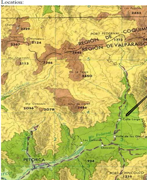
From the 1:250,000 scale map of Quillota, by the IGM. The scale has been altered by
the scanner.
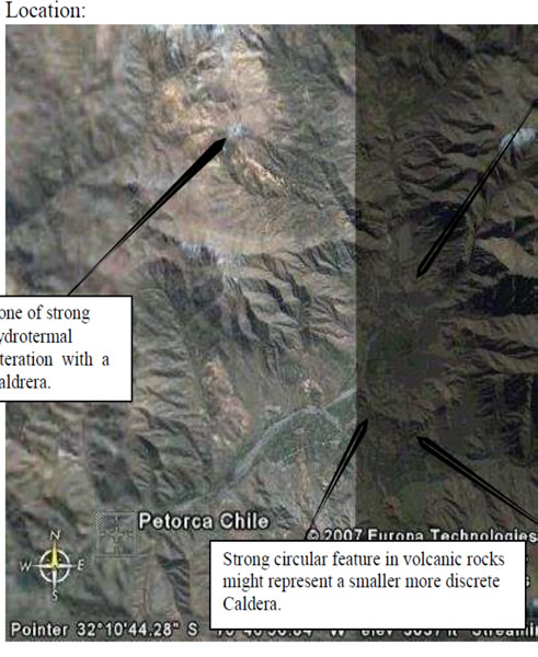
Location relative to regional geology
Evident circular
structure of the
caldera.
From the 2002 Geological map of Chile by the Servicio Nacional De Geologia Y
Mineria.
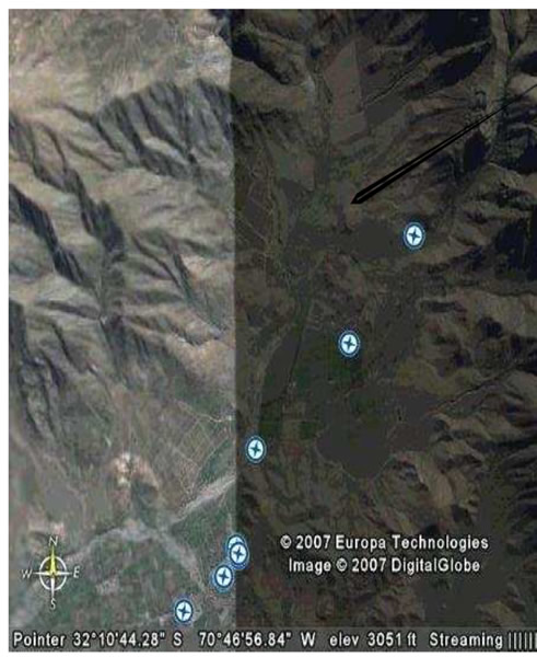
Location relative to local geology:
Calderon Copper
Project.
In this area where the arrow is pointing there has been extensive mining in the past by Minera El Bronce, (which is the traditional mining company ).
I understand that they have the mine rented out and it is currently producing. At one time they had a plant here in the valley as well, the details of the plant and water rights should be investigated and could be a great help should sufficient reserves be discovered at the New Copper Project to the South.
From the 1:250,000 scale Geologic Map of Quillota Y Portillo by: S. Rivano, P.
Sepulveda, R Boric, D. Espiñera. By SERNAGEOMIN, Publication # 73. dated 1993.
Lab report by ACME labs. – Santiago.
INFORME DE ANALISIS QUIMICO Nro: 07-20680
Recibido:
Cliente:
Proyecto:
Geologo:
Envio:
|